DAY #16 . 21 KM . SONG = "Red Dirt Road" . WEATHER = Mix of Sun and Cloud
Today started with great success as Alex and I were FINALLY able to wake up, eat brekky, pack and get a move on under an hour. As a personal best time, I set off with the feeling that the day could only get better. Farmer John (whose property we were camped on) had informed us the yesterday that we could get back to the trail via the back of his property as that was the way the trail used to go before the DOC rerouted it due to people getting lost trying to navigate through it. He informed us that he could usually tell which people would be able to make out the trail and he thought we were it. That was good enough for me to hear so I was curious to see this morning if we would be able to prove him right.
But - first we had to actually get to the back of his property. It wasn't as though he just had a house. John was a farmer. He owned LAND. Big difference. A little walk to the back gate was about a kilometre before we got there and when we did, their wasn't one gate. There was three. Using the skills of deduction (as learned through watching many episodes of Sesame Street as a kid - "which one doesn't belong?") we figured it was the middle gate we needed to go through. As John had personally given his permission for us to be going this route the night before, we figured he had probably forgotten it was locked, and so we climbed over it.
Sure enough, shortly after, we began seeing our treasured orange triangle trail markers and we happily trekked our way through more of John's farmland as we still weren't quite at the very back of his property. All was well until we came around the corner to face a cow who was standing in the middle of the path. The cow stared at us as we came closer, our hiking poles clicking on the dirt ground. The closer we got, the more uneasy the cow became and it started to make these painfully dreadful noises as though it was dying - its eyes getting really wide and wild. Alex suggested we just stay strong and walk on by it. And so we did - sidestepping it as we passed - I made sure my eyes never left the cow as I didn't get the feeling it was too happy about us being on its territory.
Just as we passed it, we took one look backwards and saw the cow start to put its head down real low and paw at the ground in a manner not unlike a bull. Both Alex and I eyed each other and then looked ahead at the next gate that we had to cross through. Like a bad dream it seemed as though that gate got further with every step we took towards it, all too aware that this cow was showing every indication of charging at us.
I held my breath as we reached the gate, catching glimpses of the angry cow in the back corner of my eye as we fumbled to untie the knot in the rope holding the gate closed so we could get to the other side safely. No sooner did we close the gate and turn around that we turned around and found ourselves face to face with about 20 cows, one who was already beginning to show mannerisms as the gaurd cow we left behind. I told Alex she could be the cow whisperer as she had grown up on a farm and I figured she'd have more experience at this than I would. And so Alex and the new cow had a staredown until eventually it let us move past.
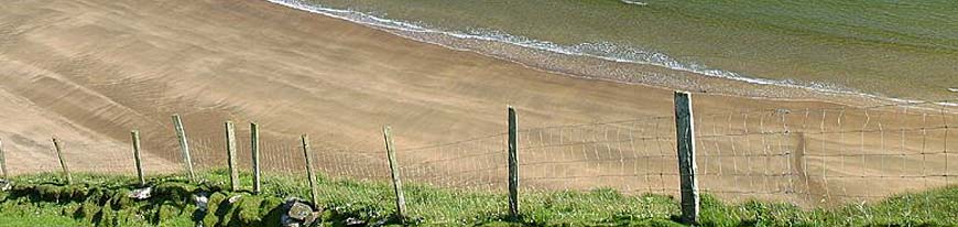
 |
| Alex enjoys the view of John's farmland. |
All sweaty and tired from muddy ground, overgrown trail and vines that seemed to have a sole purpose of trying to trip us up, we made it to the top of the ridge. As excited as we were, we soon realized we were not quite at the top of Mt. Raetea yet. We were only sitting at about 595m. We had to get to 744m. And so up we went.
By the time we got to the top we were, again, exhausted - but completely dying to see a view of the Mangamuka Gorge. Instead we teadiously walked the ridge of the mountain, trying to follow a trail that appeared to be have walked on maybe once a year and was on the very tip of everything. One wrong step to the right or left and we'd only be too greatful for the overgrown bushes that would hopefully stop us from falling into never neverland. And so we pushed on until eventually we broke through the bush and were able to see out over the gorge. It honestly took my breath away and felt as though we were on the top of the top. There was no higher we could go. We were on top of the mountain and it felt amazing.
* Check out our video of this final push to the summit at: Ahipara to Kerikeri - Trail Unknown
And then we went down. Kind of. We had to follow the ridgeline of a couple more mountains before we made our final descent towards SH 1. The sound of a car zipping by never sounded so good to my ears. We were almost there. Almost to the end of our forest tramp through Raetea. But then it happened.
We had just taken our last break before the final push and we were excitedly discussing which Back Country Cuisine freezedried meal we'd like to have for dinner when it happened. The root came out of nowhere (as they all do) and the toe of my right boot caught on it. Down I went, but not before I felt the sharp shooting pain blister out across the top of my foot. Not good.
As soon as it happened, I knew something was wrong. I just didn't know how wrong. I immediately sat down on the root I had tripped over and Alex had me put my head between my knees as the dizziness ran over me. She gave me water and some dried fruit (sugar boost) as I started to feel back to normal. The pain in my foot started to subside, but as we still had to walk and I didn't know how bad it was, I didn't want to take my boot off for fear it might balloon up from swelling. And so I carefully tried putting weight on it. It was sprained, but it didn't feel as though it would be a 2nd degree sprain or anything more major. I was very lucky, but I still had to be very careful. We had a bit of walking to do yet.
As it were, where I tripped we were only about 500m from the highway roadside. Only we didn't know that at the time and within a few minutes it was as though the forest just kind of spit us out and we stumbled onto the road stunned to be there so quickly. We were estatic to be on a flat surface again - especially with the condition of my foot - and so we walked.
Eventually we got to where we wanted to camp at the Mangamuka Picnic area. We've been going for 11.5hrs today and I am beat. All I can think of is soaking my foot in the nearby river, eating dinner and then passing out.
OCTOBER 31/10
DAY #17 . 25 KM . SONG = "Just Keep Swimming" (Finding Nemo) . WEATHER = Mix of Sun and Cloud
After yesterday being so lengthy, Alex and I both woke with a groan when the alarm went at 5 am. Neither one of us wanted to make the move to leave the cozy surrounds of our sleeping bags, so I reset the alarm for 5:30 am and shoved my arm back into my sleeping bag to get warmed up again.
By 5:30 am, things weren't shaping up to be much better. Everything hurt - though my sprained foot felt fairly decent considering what had happened yeserday, I felt as though a truck had run me over and I really had no motivation to be going anywhere - much less spend a day of road walking.
Alex didn't seem to be fairing much better than me and it took us a bit to finally sit up. Things eventually got rolling and by 7 am we were making our way back to the highway. We were back on track.
Today happened to be our first majory stretch of road walking and though I was pleased at the knowledge that my sprained foot would do well on the flat surface, the highway brough it's own kind of challenges. First off - the obvious - passing vehicles. It can be difficult on any highway to walk along side of it, but when the shoulder of the road is narrow and the ditch is really deep, things can get interesting when a logging truck comes barrelling around the corner. Secondly, the surface is nice that it is flat and there are no roots to watch out for, but because of that it becomes very hard on the feet to walk on for long periods of time. Finally - the novelty of it quickly wears off. And it did.
 |
| Alex makes a new friend on the way |
After a lengthy break we eventually made our way towards our goal of Apple Dam campsite. We hoped to begin from there tomorrow in order to try out the dry weather route option through Omahuta and Puketi Forest. Though no one knew for sure what the weather would do, we had been pretty lucky and there had been no major rain for the last week or so. That meant the river crossings for that route should be relatively alright to cross.
That being said, we have arrived at camp here and it is certainly not Apple Dam campsite. It is the Kauri Sanctuary. Though we suspected it, today we officially agreed that our map might not be the best option for us on this trek. We have been using what is essentially a road atlas to make our way up to this point. It isn't as detailed as topographical maps in the area of terrain, but it has everything there - including the Te Araroa Trail printed right on there for us. Needless to say, we've spent most of our day following the directions we wrote down from the Te Araroa Trust website only to find ourselves on a route that is most definitely not the one we want to be on. But we have a hunch we know the way. Now we just have to get a bit of sleep tonight in order to wake up tomorrow, backtrack and try the route we think it is. Fingers crossed it works out.
~ All roads lead to where you stand ~
NOVEMBER 1/10
DAY #18 . 24 KM . SONG = "Should I Stay or Should I Go?" . WEATHER = Mix of Sun and Cloud
There is something about washing up in a stream that just feels so brilliant - no matter how cold it is. And given the day Alex and I have had, it definitely makes for a nice highlight.
We managed to wake up this morning alright and began walking by 6:20am. Our goal was to backtrack down the road to the last "intersection" and choose the other route. According to the way we figured it - this other road would be what Te Araroa Trust (TAT) dubbed "Kauri Sanctuary Road" even though there were no actual sign posts indicating that.
We made it to that intersection okay and I took a deep breath. This was the moment of truth and my gut was screaming to me in fear that it was all wrong. Alex and I pressed on.
About 1km in we came to a fork in the road. And with no clear indication either way as to which direction we should pursue. Again - my instinct was to turn around, but Alex made the point that we should choose one route and at least see if it lined up with our directions. After all, we only needed to go a mere 2.5km to know. 50% chance of choosing the way we needed to go. So we chose to take the right fork.
Sure enough, 2.5km down the road there was a turnoff going south. We needed to go 1km further to find a road to our left. Onwards we went and there was the road that we needed on our left. It was our moment of truth #2. Should we continue down a road that may or may not be the correct one or turn back and do the wet weather bypass along Jacksons Road?
We calculated how much time we'd need to get back to Jacksons Road if we turned around then and then estimated we could afford to explore the new road for 5km before we'd have to turn back if there was no signs of us being on the right track.
 |
| The nice bush that felt like a million razers to walk through |
All we were looking for was a logging skid. Neither one of us knew what that was, but after trekking across BC myself, I had a pretty good hunch it would be fairly obvious to spot. The logging industry doesn't seem to do anything small scale.
Within half an hour we had found it at the bottom of the so-called road. The road had become overgrown with bush and trees to the point where it was even difficult to know where we were supposed to walk. But Alex and I found our way to the logging skid just the same. The pile of chopped up trees halted us from going anywhere further. According to TAT we were to spot trail markers a tthis point that would tell us where to go from there. There were no markers. No road. No path. No signs anywerhe indicating any other human being had tramped through the area in quite some time.
Completely dumbfounded and degected we found ourselves facing our third moment of truth for the day. It was an easy one as there way no where for us to go but back the way we came (13km) and do the wet weather route instead. And so back we went - all the while wondering if had simply missed a glimpse of the orange trail markers.
As it were, our way back was primarily downhill, causing us to go faster than our way up. So we figured we'd push it a little further to cut off some KMs for tomorrow and find a nice place to camp for the night.
By 2:15pm we had found the river we were aiming for. Only issue was that anywhere remotely possible to camp was located on a local farmer's property. I went down the dirt road and waved down the farmer who happened to be driving his tractor. I told him me and Alex were hiking past and spotted the river - before I could get the words out of my mouth that we hoped we could use his property for th enight he said that it was no problem to camp, "everyone does it."
Alex and I were elated and happily found a perfectly secluded area by the river. Completely sheltered by trees and grassy hills from all peering eyes (cows included) we quickly popped in the river to FINALLY get clean. Today was day #6 in our journey from Ahipara to Kerikeri and all that grime that had built up was really getting under our skin - literally.
And so now I sit here - fresh as a daisy - next to our private bit of river and I think that today turned out pretty awesome considering our frustrating morning of not finding the way we wanted to go.
~ It's all part of the adventure ~


0 comments:
Post a Comment